


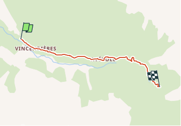
Vincendieres/Ref Averole

DUCLUZEAU
User

Length
4.8 km

Max alt
2205 m

Uphill gradient
391 m
Km-Effort
8.8 km

Min alt
1821 m

Downhill gradient
21 m
Boucle
No
Creation date :
2025-07-27 15:39:29.403
Updated on :
2025-07-27 15:39:31.332
1h59
Difficulty : Medium

FREE GPS app for hiking
 SityTrail
IGN / Geographical institutes
SityTrail Plus
The world is yours!
About
Trail Walking of 4.8 km to be discovered at Auvergne-Rhône-Alpes, Savoy, Bessans. This trail is proposed by DUCLUZEAU.
Positioning
Country:
France
Region :
Auvergne-Rhône-Alpes
Department/Province :
Savoy
Municipality :
Bessans
Location:
Unknown
Start:(Dec)
Start:(UTM)
346086 ; 5019110 (32T) N.
Comments