


LE MONT BESSOU

jeriom
User
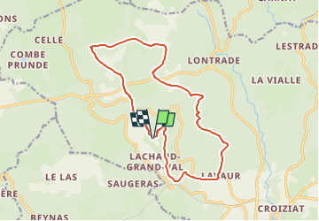

Length
16.2 km

Max alt
979 m

Uphill gradient
489 m
Km-Effort
23 km

Min alt
697 m

Downhill gradient
490 m
Boucle
Yes
Creation date :
2025-07-30 17:14:09.224
Updated on :
2025-07-30 17:14:47.046
5h10
Difficulty : Very difficult

FREE GPS app for hiking
 SityTrail
IGN / Geographical institutes
SityTrail Plus
The world is yours!
About
Trail Walking of 16.2 km to be discovered at New Aquitaine, Corrèze, Meymac. This trail is proposed by jeriom.
Positioning
Country:
France
Region :
New Aquitaine
Department/Province :
Corrèze
Municipality :
Meymac
Location:
Unknown
Start:(Dec)
Start:(UTM)
430186 ; 5045729 (31T) N.
Comments