


jld vacances

JLDECK
User
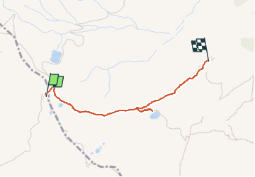

Length
2.3 km

Max alt
1988 m

Uphill gradient
4 m
Km-Effort
2.8 km

Min alt
1871 m

Downhill gradient
115 m
Boucle
No
Creation date :
2025-07-31 12:03:44.581
Updated on :
2025-07-31 12:59:32.736
51m
Difficulty : Easy

FREE GPS app for hiking
 SityTrail
IGN / Geographical institutes
SityTrail Plus
The world is yours!
About
Trail Walking of 2.3 km to be discovered at Auvergne-Rhône-Alpes, Savoy, Hauteluce. This trail is proposed by JLDECK.
Positioning
Country:
France
Region :
Auvergne-Rhône-Alpes
Department/Province :
Savoy
Municipality :
Hauteluce
Location:
Unknown
Start:(Dec)
Start:(UTM)
319198 ; 5072648 (32T) N.
Comments