


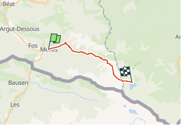
GR10 J4 Melles- refuge d'étang d'Araing

werth
User

Length
15.1 km

Max alt
2202 m

Uphill gradient
1534 m
Km-Effort
31 km

Min alt
719 m

Downhill gradient
286 m
Boucle
No
Creation date :
2025-07-30 06:24:27.948
Updated on :
2025-08-01 18:00:13.538
8h24
Difficulty : Very difficult

FREE GPS app for hiking
 SityTrail
IGN / Geographical institutes
SityTrail Plus
The world is yours!
About
Trail Walking of 15.1 km to be discovered at Occitania, Haute-Garonne, Melles. This trail is proposed by werth.
Positioning
Country:
France
Region :
Occitania
Department/Province :
Haute-Garonne
Municipality :
Melles
Location:
Unknown
Start:(Dec)
Start:(UTM)
316882 ; 4748592 (31T) N.
Comments