


Col du Beal

alinetpierre
User
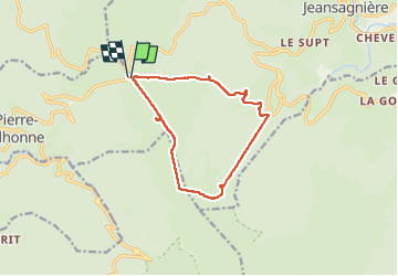

Length
11.8 km

Max alt
1580 m

Uphill gradient
554 m
Km-Effort
19.2 km

Min alt
1111 m

Downhill gradient
554 m
Boucle
Yes
Creation date :
2025-08-04 07:32:44.0
Updated on :
2025-08-04 10:58:15.62
3h24
Difficulty : Medium

FREE GPS app for hiking
 SityTrail
IGN / Geographical institutes
SityTrail Plus
The world is yours!
About
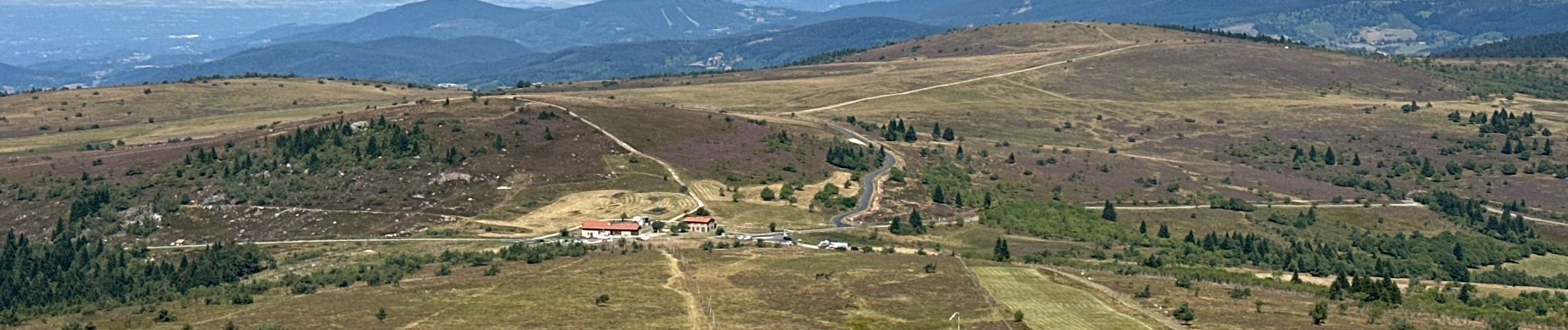
Trail Walking of 11.8 km to be discovered at Auvergne-Rhône-Alpes, Puy-de-Dôme, Saint-Pierre-la-Bourlhonne. This trail is proposed by alinetpierre.
Description
Belle randonnée on a pris le télésiège à la station de Chalmazel
Photos


Positioning
Country:
France
Region :
Auvergne-Rhône-Alpes
Department/Province :
Puy-de-Dôme
Municipality :
Saint-Pierre-la-Bourlhonne
Location:
Unknown
Start:(Dec)
Start:(UTM)
561058 ; 5059390 (31T) N.
Comments