


Lacs de Peyrefique

Thierryrando06
User

Length
16 km

Max alt
2386 m

Uphill gradient
1008 m
Km-Effort
29 km

Min alt
1544 m

Downhill gradient
1009 m
Boucle
Yes
Creation date :
2025-08-04 06:49:24.46
Updated on :
2025-08-04 14:43:18.703
7h53
Difficulty : Difficult

FREE GPS app for hiking
 SityTrail
IGN / Geographical institutes
SityTrail Plus
The world is yours!
About
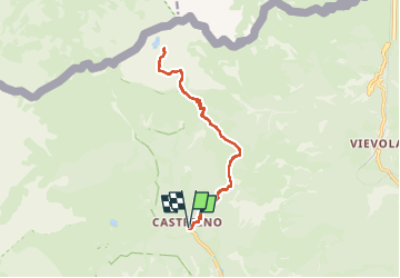
Trail Walking of 16 km to be discovered at Provence-Alpes-Côte d'Azur, Maritime Alps, Tende. This trail is proposed by Thierryrando06.
Positioning
Country:
France
Region :
Provence-Alpes-Côte d'Azur
Department/Province :
Maritime Alps
Municipality :
Tende
Location:
Unknown
Start:(Dec)
Start:(UTM)
380506 ; 4883760 (32T) N.
Comments