


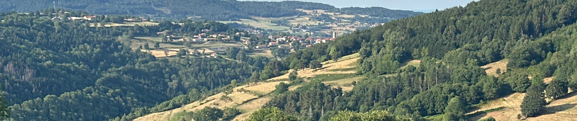
Vallée de Chorsin

alinetpierre
User
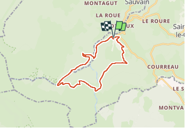

Length
13.6 km

Max alt
1362 m

Uphill gradient
520 m
Km-Effort
21 km

Min alt
872 m

Downhill gradient
521 m
Boucle
Yes
Creation date :
2025-08-05 12:14:59.0
Updated on :
2025-08-05 16:49:50.48
4h33
Difficulty : Medium

FREE GPS app for hiking
 SityTrail
IGN / Geographical institutes
SityTrail Plus
The world is yours!
About
Trail Walking of 13.6 km to be discovered at Auvergne-Rhône-Alpes, Loire, Saint-Bonnet-le-Courreau. This trail is proposed by alinetpierre.
Description
Pour azur , super randonnée très variées, cascade , hautes chaumes jasseries .
Photos


Positioning
Country:
France
Region :
Auvergne-Rhône-Alpes
Department/Province :
Loire
Municipality :
Saint-Bonnet-le-Courreau
Location:
Unknown
Start:(Dec)
Start:(UTM)
569390 ; 5056270 (31T) N.
Comments