


Queyras-Belvédère Mt Viso A/R

nicolas54230
User
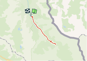

Length
10.4 km

Max alt
2175 m

Uphill gradient
380 m
Km-Effort
15.5 km

Min alt
1800 m

Downhill gradient
379 m
Boucle
Yes
Creation date :
2025-08-06 16:01:42.374
Updated on :
2025-08-06 16:02:17.111
3h30
Difficulty : Difficult

FREE GPS app for hiking
 SityTrail
IGN / Geographical institutes
SityTrail Plus
The world is yours!
About
Trail Walking of 10.4 km to be discovered at Provence-Alpes-Côte d'Azur, Hautes-Alpes, Abriès-Ristolas. This trail is proposed by nicolas54230.
Positioning
Country:
France
Region :
Provence-Alpes-Côte d'Azur
Department/Province :
Hautes-Alpes
Municipality :
Abriès-Ristolas
Location:
Ristolas
Start:(Dec)
Start:(UTM)
341510 ; 4955575 (32T) N.
Comments