


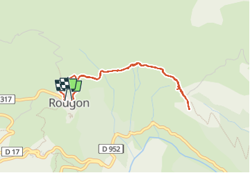
Rougon balade autour du village

rbruant
User

Length
4 km

Max alt
1019 m

Uphill gradient
111 m
Km-Effort
5.5 km

Min alt
959 m

Downhill gradient
116 m
Boucle
Yes
Creation date :
2025-08-06 15:33:40.419
Updated on :
2025-08-06 17:20:48.525
1h46
Difficulty : Very easy

FREE GPS app for hiking
 SityTrail
IGN / Geographical institutes
SityTrail Plus
The world is yours!
About
Trail Walking of 4 km to be discovered at Provence-Alpes-Côte d'Azur, Alpes-de-Haute-Provence, Rougon. This trail is proposed by rbruant.
Positioning
Country:
France
Region :
Provence-Alpes-Côte d'Azur
Department/Province :
Alpes-de-Haute-Provence
Municipality :
Rougon
Location:
Unknown
Start:(Dec)
Start:(UTM)
290978 ; 4852850 (32T) N.
Comments