


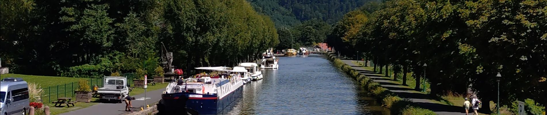
Boucle Saverne Plan incliné Vallée des éclusiers

zazie
User
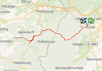

Length
39 km

Max alt
268 m

Uphill gradient
501 m
Km-Effort
46 km

Min alt
186 m

Downhill gradient
502 m
Boucle
Yes
Creation date :
2025-08-07 08:51:40.308
Updated on :
2025-08-07 12:51:19.364
2h46
Difficulty : Easy

FREE GPS app for hiking
 SityTrail
IGN / Geographical institutes
SityTrail Plus
The world is yours!
About
Trail Electric bike of 39 km to be discovered at Grand Est, Bas-Rhin, Saverne. This trail is proposed by zazie.
Photos


29 photos in total. Please click on a photo to see them all in the gallery.
Positioning
Country:
France
Region :
Grand Est
Department/Province :
Bas-Rhin
Municipality :
Saverne
Location:
Unknown
Start:(Dec)
Start:(UTM)
379526 ; 5400029 (32U) N.
Comments