


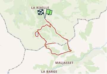
Queyras-Ceillac-Cols Tronchet-Girardin-Lac St Anne

nicolas54230
User

Length
16.8 km

Max alt
2848 m

Uphill gradient
1228 m
Km-Effort
33 km

Min alt
1965 m

Downhill gradient
1227 m
Boucle
Yes
Creation date :
2025-08-09 08:19:10.281
Updated on :
2025-08-09 08:20:17.078
7h31
Difficulty : Very difficult

FREE GPS app for hiking
 SityTrail
IGN / Geographical institutes
SityTrail Plus
The world is yours!
About
Trail Walking of 16.8 km to be discovered at Provence-Alpes-Côte d'Azur, Hautes-Alpes, Ceillac. This trail is proposed by nicolas54230.
Positioning
Country:
France
Region :
Provence-Alpes-Côte d'Azur
Department/Province :
Hautes-Alpes
Municipality :
Ceillac
Location:
Unknown
Start:(Dec)
Start:(UTM)
327159 ; 4944125 (32T) N.
Comments