


boucle Foy La heronniere

vrenneson
User
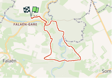

Length
7.6 km

Max alt
219 m

Uphill gradient
222 m
Km-Effort
10.6 km

Min alt
126 m

Downhill gradient
223 m
Boucle
Yes
Creation date :
2025-08-10 13:47:03.673
Updated on :
2025-08-10 15:46:26.275
1h54
Difficulty : Medium

FREE GPS app for hiking
 SityTrail
IGN / Geographical institutes
SityTrail Plus
The world is yours!
About
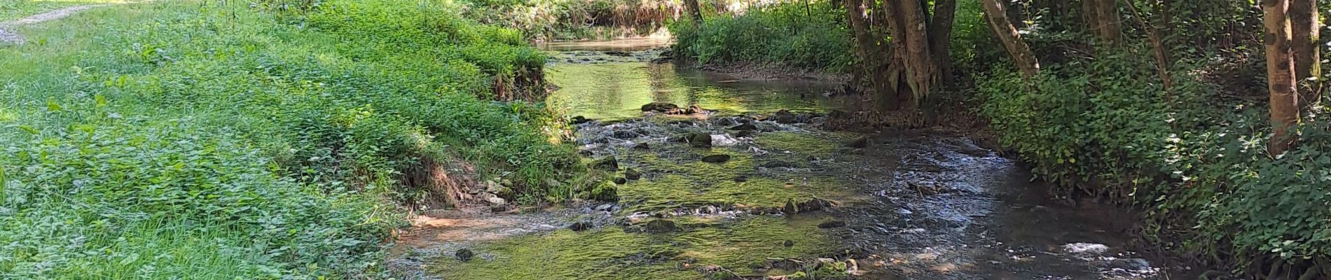
Trail Walking of 7.6 km to be discovered at Wallonia, Namur, Onhaye. This trail is proposed by vrenneson.
Photos

Positioning
Country:
Belgium
Region :
Wallonia
Department/Province :
Namur
Municipality :
Onhaye
Location:
Unknown
Start:(Dec)
Start:(UTM)
628594 ; 5572858 (31U) N.
Comments