


refuge du Lavey

jmho
User
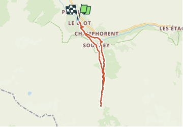

Length
12.8 km

Max alt
1808 m

Uphill gradient
642 m
Km-Effort
21 km

Min alt
1368 m

Downhill gradient
641 m
Boucle
Yes
Creation date :
2025-08-11 07:11:57.996
Updated on :
2025-08-11 14:53:35.79
5h40
Difficulty : Difficult

FREE GPS app for hiking
 SityTrail
IGN / Geographical institutes
SityTrail Plus
The world is yours!
About
Trail Walking of 12.8 km to be discovered at Auvergne-Rhône-Alpes, Isère, Saint-Christophe-en-Oisans. This trail is proposed by jmho.
Positioning
Country:
France
Region :
Auvergne-Rhône-Alpes
Department/Province :
Isère
Municipality :
Saint-Christophe-en-Oisans
Location:
Unknown
Start:(Dec)
Start:(UTM)
278347 ; 4980170 (32T) N.
Comments