


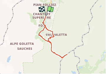
Vers Punta Leynir par Col Rosset retour par col Cornet et Monte Cornet

mpignon
User

Length
15.3 km

Max alt
3119 m

Uphill gradient
1461 m
Km-Effort
35 km

Min alt
1849 m

Downhill gradient
1461 m
Boucle
Yes
Creation date :
2025-08-13 05:27:54.153
Updated on :
2025-08-16 13:39:03.119
7h54
Difficulty : Very difficult

FREE GPS app for hiking
 SityTrail
IGN / Geographical institutes
SityTrail Plus
The world is yours!
About
Trail Walking of 15.3 km to be discovered at Aosta Valley, Unknown, Rhêmes-Notre-Dame. This trail is proposed by mpignon.
Positioning
Country:
Italy
Region :
Aosta Valley
Department/Province :
Unknown
Municipality :
Rhêmes-Notre-Dame
Location:
Unknown
Start:(Dec)
Start:(UTM)
352089 ; 5045151 (32T) N.
Comments