


Queyras-Col de Chamoussière/de St Véran/Agnel/Pic Caramantran

nicolas54230
User
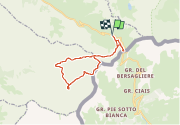

Length
14.7 km

Max alt
3007 m

Uphill gradient
956 m
Km-Effort
27 km

Min alt
2484 m

Downhill gradient
956 m
Boucle
Yes
Creation date :
2025-08-15 15:13:55.17
Updated on :
2025-08-15 15:15:46.813
6h13
Difficulty : Very difficult

FREE GPS app for hiking
 SityTrail
IGN / Geographical institutes
SityTrail Plus
The world is yours!
About
Trail Walking of 14.7 km to be discovered at Provence-Alpes-Côte d'Azur, Hautes-Alpes, Molines-en-Queyras. This trail is proposed by nicolas54230.
Positioning
Country:
France
Region :
Provence-Alpes-Côte d'Azur
Department/Province :
Hautes-Alpes
Municipality :
Molines-en-Queyras
Location:
Unknown
Start:(Dec)
Start:(UTM)
339271 ; 4950666 (32T) N.
Comments