


Tellin VTT 32 Kms

B0uille
User
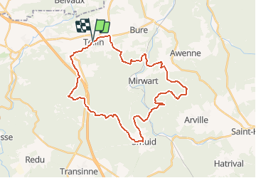

Length
32 km

Max alt
488 m

Uphill gradient
811 m
Km-Effort
43 km

Min alt
243 m

Downhill gradient
813 m
Boucle
Yes
Creation date :
2015-08-16 00:00:00.0
Updated on :
2015-08-16 00:00:00.0
2h45
Difficulty : Medium

FREE GPS app for hiking
 SityTrail
IGN / Geographical institutes
SityTrail Plus
The world is yours!
About
Trail Mountain bike of 32 km to be discovered at Wallonia, Luxembourg, Tellin. This trail is proposed by B0uille.


Positioning
Country:
Belgium
Region :
Wallonia
Department/Province :
Luxembourg
Municipality :
Tellin
Location:
Tellin
Start:(Dec)
Start:(UTM)
658601 ; 5549945 (31U) N.
Comments