


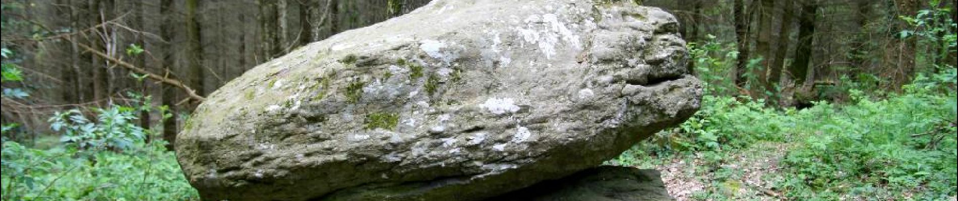
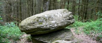
La pierre branlante par Les Jouffrets.

Gegetop
User

Length
10.2 km

Max alt
628 m

Uphill gradient
303 m
Km-Effort
14.3 km

Min alt
418 m

Downhill gradient
304 m
Boucle
Yes
Creation date :
2015-08-21 00:00:00.0
Updated on :
2015-08-21 00:00:00.0
2h36
Difficulty : Easy

FREE GPS app for hiking
 SityTrail
IGN / Geographical institutes
SityTrail Plus
The world is yours!
About
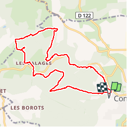
Trail Walking of 10.2 km to be discovered at Auvergne-Rhône-Alpes, Puy-de-Dôme, Combronde. This trail is proposed by Gegetop.
Description
Cette petite rando est principalement dans les bois, elle emprunte en partie le balisage jaune et permet de visiter la pierre branlante entre Les Jouffrets et Les Ballages.
Photos


Positioning
Country:
France
Region :
Auvergne-Rhône-Alpes
Department/Province :
Puy-de-Dôme
Municipality :
Combronde
Location:
Unknown
Start:(Dec)
Start:(UTM)
506208 ; 5092065 (31T) N.
Comments