


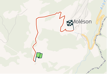


7.5 km | 13.1 km-effort


User


FREE GPS app for hiking
 SityTrail
IGN / Geographical institutes
SityTrail World
The world is yours!
Trail Walking of 2.7 km to be discovered at Fribourg, Gruyère District, Gruyères. This trail is proposed by yveshumbert.
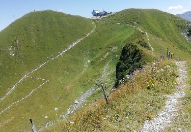
Moléson-sur-Gruyère.Parquer votre voiture au parking à Moléson-sur-Gruyères.Prendre le funiculaire pour vous rendre au Plan Francey.La descente à pied se fait par un joli chemin facile.Il y a la possibilité de manger dans une auberge d' alapage au Plan Francey ou à Moléson-sur-Gruyères

Snowshoes
On foot

Walking
Walking

Other activity
Other activity

Cycle

Walking
Walking