Trail Walking Mendionde - 
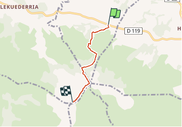
Ascencion Mont Baigora - Photo
 psyberty
psyberty

User

© OpenStreetMap contributors
Length
Length
3.2 km
Max alt
Max alt
885 m
Uphill gradient
Uphill gradient
598 m
Km-Effort
Km-Effort  
9.3 km
Min alt
Min alt
294 m
Downhill gradient
Downhill gradient
17 m
Boucle
Boucle
No
Creation date :
2015-09-05 00:00:00.0
Updated on :
2015-09-05 00:00:00.0

(0 Reviews)

Walking
Walking
2h05
Difficulty : Difficult

Scan this QR Code to open this trail in the SityTrail application

FREE GPS app for hiking

Logo SityTrail SityTrail

IGN / Geographical institutes

Download SityTrail from the App Store Download SityTrail from Google Play

Logo SityTrail SityTrail Plus

The world is yours!

Download SityTrail from the App Store Download SityTrail from Google Play Download SityTrail on Huawei AppGallery

About

Trail Walking of 3.2 km to be discovered at New Aquitaine, Pyrénées-Atlantiques, Mendionde. This trail is proposed by psyberty.

Description

La vue est splendide et permet de voir l'océan par beau temps. On peut y voir le décollage de parapentistes.
Départ au parking de la base de loisirs.Retour par le même sentier ou par la route du train.

Elevation profile

Positioning

Country:
France
Region :
New Aquitaine
Department/Province :
Pyrénées-Atlantiques
Municipality :
Mendionde
Location:
Unknown
Start:(UTM)
639289 ; 4796583 (30T) N.


Close
My subscriptions