


villefranche de rouergue

betf
User
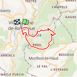

Length
10.9 km

Max alt
532 m

Uphill gradient
331 m
Km-Effort
15.3 km

Min alt
254 m

Downhill gradient
328 m
Boucle
Yes
Creation date :
2015-09-13 00:00:00.0
Updated on :
2015-09-13 00:00:00.0
3h19
Difficulty : Easy

FREE GPS app for hiking
 SityTrail
IGN / Geographical institutes
SityTrail Plus
The world is yours!
About
Trail Walking of 10.9 km to be discovered at Occitania, Aveyron, Villefranche-de-Rouergue. This trail is proposed by betf.
Description
sentier des sources
Positioning
Country:
France
Region :
Occitania
Department/Province :
Aveyron
Municipality :
Villefranche-de-Rouergue
Location:
Unknown
Start:(Dec)
Start:(UTM)
423278 ; 4911082 (31T) N.
Comments
Superb Application