


pré du four- col de l'arc

maupassant38
User
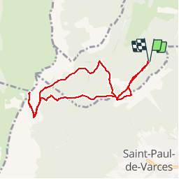

Length
8.4 km

Max alt
1735 m

Uphill gradient
628 m
Km-Effort
16.8 km

Min alt
1172 m

Downhill gradient
626 m
Boucle
Yes
Creation date :
2019-02-22 22:31:23.563
Updated on :
2019-02-22 22:31:23.574
2h30
Difficulty : Medium

FREE GPS app for hiking
 SityTrail
IGN / Geographical institutes
SityTrail Plus
The world is yours!
About
Trail Walking of 8.4 km to be discovered at Auvergne-Rhône-Alpes, Isère, Varces-Allières-et-Risset. This trail is proposed by maupassant38.
Positioning
Country:
France
Region :
Auvergne-Rhône-Alpes
Department/Province :
Isère
Municipality :
Varces-Allières-et-Risset
Location:
Unknown
Start:(Dec)
Start:(UTM)
707988 ; 4996204 (31T) N.
Comments