


pointe de la levriere

whisper73
User
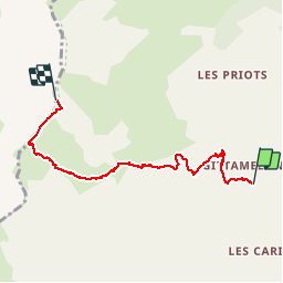

Length
5.6 km

Max alt
2556 m

Uphill gradient
986 m
Km-Effort
15.8 km

Min alt
1567 m

Downhill gradient
111 m
Boucle
No
Creation date :
2015-09-30 00:00:00.0
Updated on :
2015-09-30 00:00:00.0
2h26
Difficulty : Easy

FREE GPS app for hiking
 SityTrail
IGN / Geographical institutes
SityTrail Plus
The world is yours!
About
Trail Walking of 5.6 km to be discovered at Auvergne-Rhône-Alpes, Savoy, Les Belleville. This trail is proposed by whisper73.
Positioning
Country:
France
Region :
Auvergne-Rhône-Alpes
Department/Province :
Savoy
Municipality :
Les Belleville
Location:
Saint-Martin-de-Belleville
Start:(Dec)
Start:(UTM)
301730 ; 5024811 (32T) N.
Comments