


Chemin du Val Dallet

dominiquelouis
User
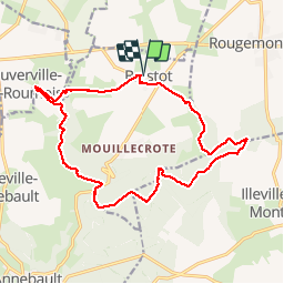

Length
16.1 km

Max alt
139 m

Uphill gradient
221 m
Km-Effort
19 km

Min alt
51 m

Downhill gradient
222 m
Boucle
Yes
Creation date :
2015-10-06 00:00:00.0
Updated on :
2015-10-06 00:00:00.0
4h10
Difficulty : Difficult

FREE GPS app for hiking
 SityTrail
IGN / Geographical institutes
SityTrail Plus
The world is yours!
About
Trail Walking of 16.1 km to be discovered at Normandy, Eure, Brestot. This trail is proposed by dominiquelouis.
Description
Proche de la vallée de la Risle en Normandie, une randonnée pédestre sportive de 16 km révèle un vallon bocager bien préservé et une partie peu connue de la forêt domaniale de Montfort
Positioning
Country:
France
Region :
Normandy
Department/Province :
Eure
Municipality :
Brestot
Location:
Unknown
Start:(Dec)
Start:(UTM)
331843 ; 5469182 (31U) N.
Comments