


ronde du frontOnaIs

PhilB24
User

Length
32 km

Max alt
229 m

Uphill gradient
445 m
Km-Effort
38 km

Min alt
126 m

Downhill gradient
445 m
Boucle
Yes
Creation date :
2015-10-06 00:00:00.0
Updated on :
2022-02-18 18:12:26.005
2h58
Difficulty : Medium

FREE GPS app for hiking
 SityTrail
IGN / Geographical institutes
SityTrail Plus
The world is yours!
About
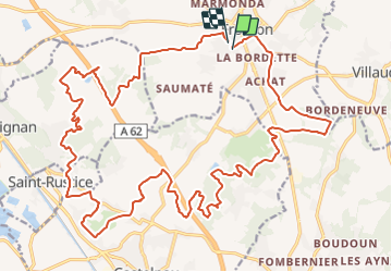
Trail Mountain bike of 32 km to be discovered at Occitania, Haute-Garonne, Fronton. This trail is proposed by PhilB24.
Description
2015
Positioning
Country:
France
Region :
Occitania
Department/Province :
Haute-Garonne
Municipality :
Fronton
Location:
Unknown
Start:(Dec)
Start:(UTM)
370204 ; 4854914 (31T) N.
Comments
ronde du Frontonais 2015