


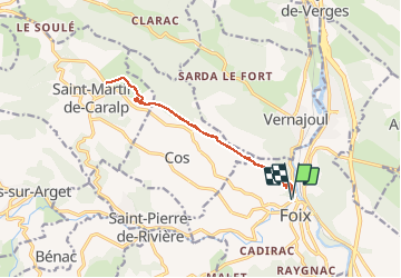
Foix - Saint Sauveur - St Martin de Caralp

Cachariege
User

Length
13.2 km

Max alt
732 m

Uphill gradient
887 m
Km-Effort
25 km

Min alt
384 m

Downhill gradient
886 m
Boucle
Yes
Creation date :
2015-10-10 00:00:00.0
Updated on :
2015-10-10 00:00:00.0
4h51
Difficulty : Difficult

FREE GPS app for hiking
 SityTrail
IGN / Geographical institutes
SityTrail Plus
The world is yours!
About
Trail Walking of 13.2 km to be discovered at Occitania, Ariège, Foix. This trail is proposed by Cachariege.
Description
Demarrage de Foix, montée au St Sauveur . On continue en crète du St Sauveur au Pech .
Arrivée en Col des Bouich .
REtour par la même route mais en faisant une petite montée au Roc de Caralp

Positioning
Country:
France
Region :
Occitania
Department/Province :
Ariège
Municipality :
Foix
Location:
Unknown
Start:(Dec)
Start:(UTM)
386177 ; 4758148 (31T) N.
Comments