


gr96 grp mta

COMAN
User

Length
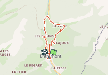
7.3 km

Max alt
899 m

Uphill gradient
181 m
Km-Effort
9.7 km

Min alt
748 m

Downhill gradient
181 m
Boucle
Yes
Creation date :
2015-10-20 00:00:00.0
Updated on :
2015-10-20 00:00:00.0
2h07
Difficulty : Easy

FREE GPS app for hiking
 SityTrail
IGN / Geographical institutes
SityTrail Plus
The world is yours!
About
Trail Walking of 7.3 km to be discovered at Auvergne-Rhône-Alpes, Upper Savoy, Glières-Val-de-Borne. This trail is proposed by COMAN.
Description
variante
Photos


37 photos in total. Please click on a photo to see them all in the gallery.
Positioning
Country:
France
Region :
Auvergne-Rhône-Alpes
Department/Province :
Upper Savoy
Municipality :
Glières-Val-de-Borne
Location:
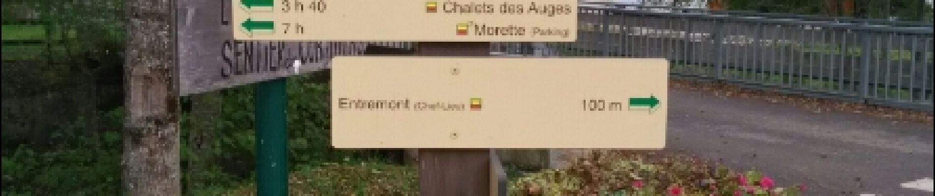
Entremont
Start:(Dec)
Start:(UTM)
297537 ; 5092663 (32T) N.
Comments