


cime noire

whisper73
User
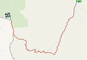

Length
4.2 km

Max alt
2611 m

Uphill gradient
745 m
Km-Effort
11.6 km

Min alt
1859 m

Downhill gradient
0 m
Boucle
No
Creation date :
2015-11-06 00:00:00.0
Updated on :
2015-11-06 00:00:00.0
1h39
Difficulty : Easy

FREE GPS app for hiking
 SityTrail
IGN / Geographical institutes
SityTrail Plus
The world is yours!
About
Trail Walking of 4.2 km to be discovered at Auvergne-Rhône-Alpes, Savoy, Les Belleville. This trail is proposed by whisper73.
Positioning
Country:
France
Region :
Auvergne-Rhône-Alpes
Department/Province :
Savoy
Municipality :
Les Belleville
Location:
Saint-Martin-de-Belleville
Start:(Dec)
Start:(UTM)
301686 ; 5021335 (32T) N.
Comments