Etroeungt Circuit du buffle

Blourouce
User

Length
11.6 km

Max alt
193 m

Uphill gradient
167 m
Km-Effort
13.8 km

Min alt
153 m

Downhill gradient
167 m
Boucle
Yes
Creation date :
2019-01-12 16:54:29.066
Updated on :
2019-01-12 16:54:29.073
3h00
Difficulty : Easy

FREE GPS app for hiking
 SityTrail
IGN / Geographical institutes
SityTrail Plus
The world is yours!
About
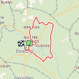
Trail Walking of 11.6 km to be discovered at Hauts-de-France, Nord, Étrœungt. This trail is proposed by Blourouce.
Positioning
Country:
France
Region :
Hauts-de-France
Department/Province :
Nord
Municipality :
Étrœungt
Location:
Unknown
Start:(Dec)
Start:(UTM)
566441 ; 5545567 (31U) N.
Comments