


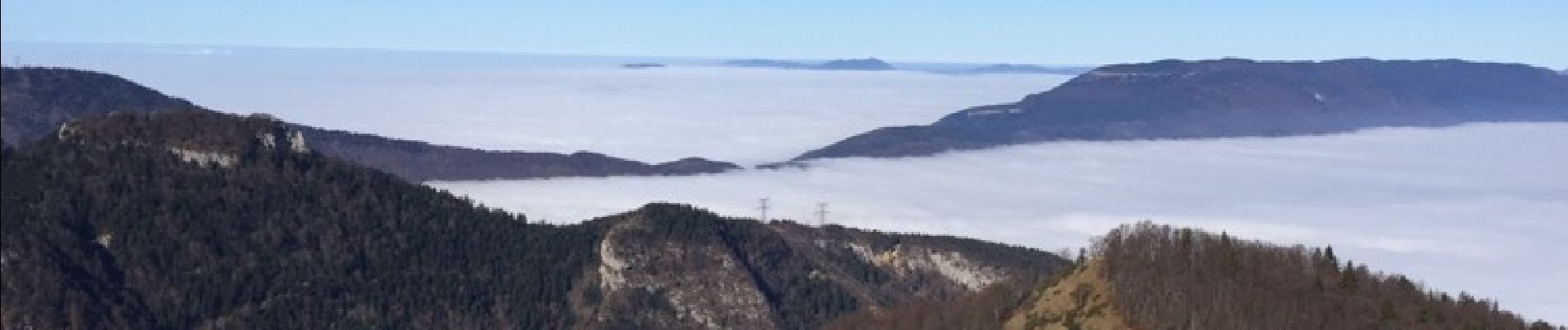
col du granier col de la gorgeât

cocosteph
User
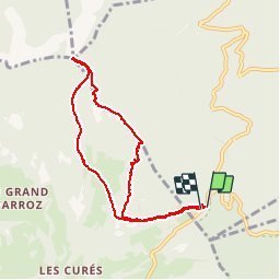

Length
7.9 km

Max alt
1552 m

Uphill gradient
477 m
Km-Effort
14.2 km

Min alt
1136 m

Downhill gradient
475 m
Boucle
Yes
Creation date :
2015-11-11 00:00:00.0
Updated on :
2015-11-11 00:00:00.0
3h08
Difficulty : Medium

FREE GPS app for hiking
 SityTrail
IGN / Geographical institutes
SityTrail Plus
The world is yours!
About
Trail Other activity of 7.9 km to be discovered at Auvergne-Rhône-Alpes, Savoy, Apremont. This trail is proposed by cocosteph.
Photos


Positioning
Country:
France
Region :
Auvergne-Rhône-Alpes
Department/Province :
Savoy
Municipality :
Apremont
Location:
Unknown
Start:(Dec)
Start:(UTM)
727810 ; 5040438 (31T) N.
Comments