


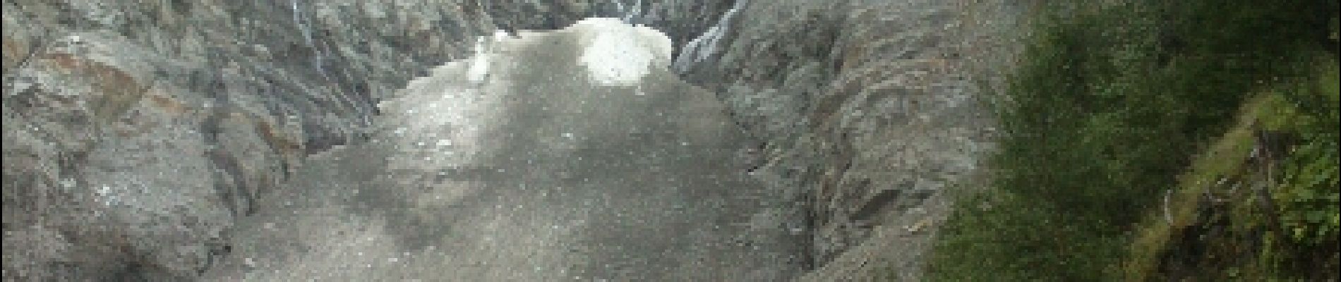
glacier des bossons

fredtruc27
User
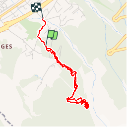

Length
5.8 km

Max alt
1497 m

Uphill gradient
427 m
Km-Effort
11.6 km

Min alt
1043 m

Downhill gradient
465 m
Boucle
No
Creation date :
2015-11-15 00:00:00.0
Updated on :
2015-11-15 00:00:00.0
1h43
Difficulty : Medium

FREE GPS app for hiking
 SityTrail
IGN / Geographical institutes
SityTrail Plus
The world is yours!
About
Trail Walking of 5.8 km to be discovered at Auvergne-Rhône-Alpes, Upper Savoy, Chamonix-Mont-Blanc. This trail is proposed by fredtruc27.
Description
montée tranquille en marchant - descente en courant- superbe vue sur le glacier des bossons
Photos


Positioning
Country:
France
Region :
Auvergne-Rhône-Alpes
Department/Province :
Upper Savoy
Municipality :
Chamonix-Mont-Blanc
Location:
Unknown
Start:(Dec)
Start:(UTM)
332660 ; 5085271 (32T) N.
Comments