


via corda alpina

fredtruc27
User

Length
15.2 km

Max alt
1625 m

Uphill gradient
584 m
Km-Effort
23 km

Min alt
1060 m

Downhill gradient
627 m
Boucle
No
Creation date :
2015-11-15 00:00:00.0
Updated on :
2015-11-15 00:00:00.0
6h09
Difficulty : Very difficult

FREE GPS app for hiking
 SityTrail
IGN / Geographical institutes
SityTrail Plus
The world is yours!
About
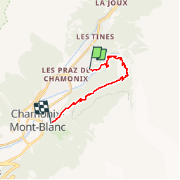
Trail Via ferrata of 15.2 km to be discovered at Auvergne-Rhône-Alpes, Upper Savoy, Chamonix-Mont-Blanc. This trail is proposed by fredtruc27.
Positioning
Country:
France
Region :
Auvergne-Rhône-Alpes
Department/Province :
Upper Savoy
Municipality :
Chamonix-Mont-Blanc
Location:
Unknown
Start:(Dec)
Start:(UTM)
337119 ; 5089774 (32T) N.
Comments