


Les 4 vallees du Sancy

vdub199
User

Length
25 km

Max alt
1862 m

Uphill gradient
1821 m
Km-Effort
49 km

Min alt
1227 m

Downhill gradient
1820 m
Boucle
Yes
Creation date :
2014-12-10 00:00:00.0
Updated on :
2014-12-10 00:00:00.0
7h00
Difficulty : Very difficult

FREE GPS app for hiking
 SityTrail
IGN / Geographical institutes
SityTrail Plus
The world is yours!
About
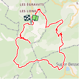
Trail Walking of 25 km to be discovered at Auvergne-Rhône-Alpes, Puy-de-Dôme, Mont-Dore. This trail is proposed by vdub199.
Description
Mont Dore, Cirque de la Fontaine salee, Super besse, Chaudefour.
Positioning
Country:
France
Region :
Auvergne-Rhône-Alpes
Department/Province :
Puy-de-Dôme
Municipality :
Mont-Dore
Location:
Unknown
Start:(Dec)
Start:(UTM)
485561 ; 5043214 (31T) N.
Comments
beaucoup de Bug depuis quelques temps. à suivre.