


Cime CACCIA, SIGALE (06)

ch2slv
User
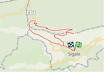


3h42
Difficulty : Medium

FREE GPS app for hiking
 SityTrail
IGN / Geographical institutes
SityTrail Plus
The world is yours!
About
Trail Walking of 9.3 km to be discovered at Provence-Alpes-Côte d'Azur, Maritime Alps, Sigale. This trail is proposed by ch2slv.
Description
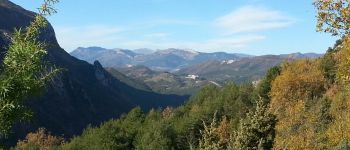
Boucle au départ de SIGALE. En haut vue 360° sur les pré-Alpes.Longue descente en sous bois en ubac vers la belle clue du RIOLAN; Le trajaet retour passe normalement par le petit pont de pierre et évite la route (souvent déserte!)
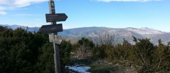
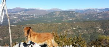
Photos
 - Photo 1")
 - Photo 2")
 - Photo 3")

Positioning
Comments
Belle rando avec des paysages variés. Nous avons dévié sur le retour en passant sur le GR651 en contrebas de la route.