


Lachal-Ss le col Glandon

Bogapuki
User
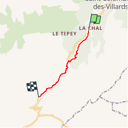

Length
5.8 km

Max alt
1644 m

Uphill gradient
453 m
Km-Effort
10.4 km

Min alt
1211 m

Downhill gradient
24 m
Boucle
No
Creation date :
2018-11-25 09:19:18.252
Updated on :
2018-11-25 09:19:18.252
2h27
Difficulty : Easy

FREE GPS app for hiking
 SityTrail
IGN / Geographical institutes
SityTrail Plus
The world is yours!
About
Trail Walking of 5.8 km to be discovered at Auvergne-Rhône-Alpes, Savoy, Saint-Colomban-des-Villards. This trail is proposed by Bogapuki.
Description
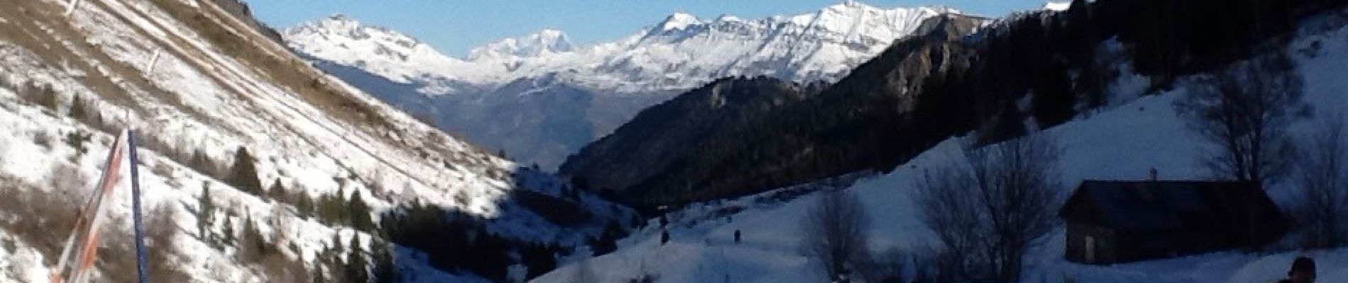
Magnifique vue sur le Mont Blanc.
Photos

Positioning
Country:
France
Region :
Auvergne-Rhône-Alpes
Department/Province :
Savoy
Municipality :
Saint-Colomban-des-Villards
Location:
Unknown
Start:(Dec)
Start:(UTM)
281259 ; 5017866 (32T) N.
Comments