


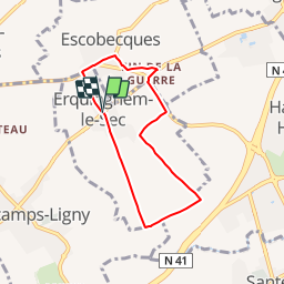
Erquinghem le sec 5.8 km

Blourouce
User

Length
5.4 km

Max alt
44 m

Uphill gradient
27 m
Km-Effort
5.8 km

Min alt
21 m

Downhill gradient
28 m
Boucle
Yes
Creation date :
2019-01-12 16:54:28.08
Updated on :
2019-01-12 16:54:28.087
1h19
Difficulty : Very easy

FREE GPS app for hiking
 SityTrail
IGN / Geographical institutes
SityTrail Plus
The world is yours!
About
Trail Walking of 5.4 km to be discovered at Hauts-de-France, Nord, Erquinghem-le-Sec. This trail is proposed by Blourouce.
Description
Parking
50.614409, 2.929191
Positioning
Country:
France
Region :
Hauts-de-France
Department/Province :
Nord
Municipality :
Erquinghem-le-Sec
Location:
Unknown
Start:(Dec)
Start:(UTM)
494989 ; 5606962 (31U) N.
Comments