


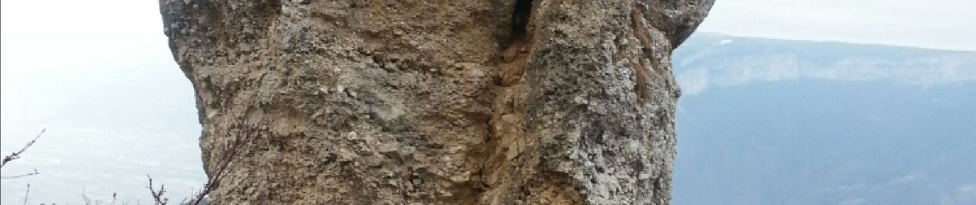
proveyzieux - rocher de l'Eglise

maupassant38
User
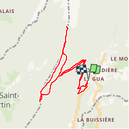

Length
9.4 km

Max alt
1489 m

Uphill gradient
902 m
Km-Effort
21 km

Min alt
643 m

Downhill gradient
902 m
Boucle
Yes
Creation date :
2019-02-22 22:31:17.228
Updated on :
2019-02-22 22:31:17.252
3h27
Difficulty : Medium

FREE GPS app for hiking
 SityTrail
IGN / Geographical institutes
SityTrail Plus
The world is yours!
About
Trail Walking of 9.4 km to be discovered at Auvergne-Rhône-Alpes, Isère, Proveysieux. This trail is proposed by maupassant38.
Photos


Positioning
Country:
France
Region :
Auvergne-Rhône-Alpes
Department/Province :
Isère
Municipality :
Proveysieux
Location:
Unknown
Start:(Dec)
Start:(UTM)
712177 ; 5017167 (31T) N.
Comments