


20150119-Les Brulins

doudet
User
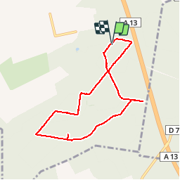

Length
7.1 km

Max alt
132 m

Uphill gradient
113 m
Km-Effort
8.6 km

Min alt
34 m

Downhill gradient
115 m
Boucle
Yes
Creation date :
2018-09-11 09:11:57.258
Updated on :
2018-09-11 09:11:57.258
1h53
Difficulty : Very easy

FREE GPS app for hiking
 SityTrail
IGN / Geographical institutes
SityTrail Plus
The world is yours!
About
Trail Walking of 7.1 km to be discovered at Normandy, Eure, Criquebeuf-sur-Seine. This trail is proposed by doudet.
Description
Boucle A-R
Positioning
Country:
France
Region :
Normandy
Department/Province :
Eure
Municipality :
Criquebeuf-sur-Seine
Location:
Unknown
Start:(Dec)
Start:(UTM)
363049 ; 5461760 (31U) N.
Comments