2016-01-27 Rando Seine-Port et sa Forêtt

jchezlemas
User

Length
19.1 km

Max alt
96 m

Uphill gradient
212 m
Km-Effort
22 km

Min alt
36 m

Downhill gradient
211 m
Boucle
Yes
Creation date :
2016-03-09 00:00:00.0
Updated on :
2016-03-09 00:00:00.0
4h46
Difficulty : Easy

FREE GPS app for hiking
 SityTrail
IGN / Geographical institutes
SityTrail Plus
The world is yours!
About
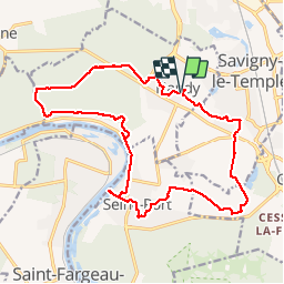
Trail Walking of 19.1 km to be discovered at Ile-de-France, Seine-et-Marne, Nandy. This trail is proposed by jchezlemas.
Positioning
Country:
France
Region :
Ile-de-France
Department/Province :
Seine-et-Marne
Municipality :
Nandy
Location:
Unknown
Start:(Dec)
Start:(UTM)
467915 ; 5380882 (31U) N.
Comments