


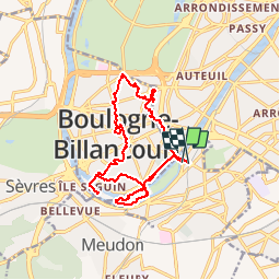
2016-02-08 Rando ile Seguin et ile St Germain

jchezlemas
User

Length
15.4 km

Max alt
52 m

Uphill gradient
158 m
Km-Effort
17.5 km

Min alt
21 m

Downhill gradient
150 m
Boucle
Yes
Creation date :
2016-03-09 00:00:00.0
Updated on :
2016-03-09 00:00:00.0
3h45
Difficulty : Easy

FREE GPS app for hiking
 SityTrail
IGN / Geographical institutes
SityTrail Plus
The world is yours!
About
Trail Walking of 15.4 km to be discovered at Ile-de-France, Hauts-de-Seine, Issy-les-Moulineaux. This trail is proposed by jchezlemas.
Positioning
Country:
France
Region :
Ile-de-France
Department/Province :
Hauts-de-Seine
Municipality :
Issy-les-Moulineaux
Location:
Unknown
Start:(Dec)
Start:(UTM)
445722 ; 5408781 (31U) N.
Comments