


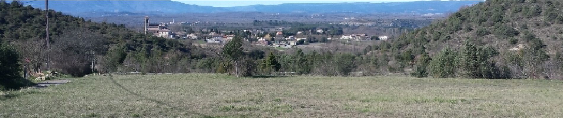
Grospierre - le Chastelas - Font - vive - 21 février 2016

morganee
User

Length
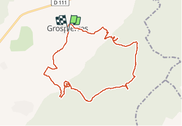
11 km

Max alt
378 m

Uphill gradient
320 m
Km-Effort
15.3 km

Min alt
129 m

Downhill gradient
319 m
Boucle
Yes
Creation date :
2019-07-19 19:06:04.637
Updated on :
2019-07-19 19:06:04.765
3h32
Difficulty : Easy

FREE GPS app for hiking
 SityTrail
IGN / Geographical institutes
SityTrail Plus
The world is yours!
About
Trail Walking of 11 km to be discovered at Auvergne-Rhône-Alpes, Ardèche, Grospierres. This trail is proposed by morganee.
Photos


Positioning
Country:
France
Region :
Auvergne-Rhône-Alpes
Department/Province :
Ardèche
Municipality :
Grospierres
Location:
Unknown
Start:(Dec)
Start:(UTM)
602735 ; 4917036 (31T) N.
Comments