


mouterhouse_point_rencontre_2016

lucienp
User
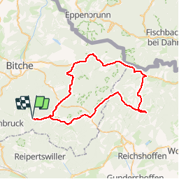

Length
54 km

Max alt
338 m

Uphill gradient
881 m
Km-Effort
65 km

Min alt
202 m

Downhill gradient
885 m
Boucle
Yes
Creation date :
2016-03-10 00:00:00.0
Updated on :
2016-03-10 00:00:00.0
3h42
Difficulty : Unknown

FREE GPS app for hiking
 SityTrail
IGN / Geographical institutes
SityTrail Plus
The world is yours!
About
Trail Cycle of 54 km to be discovered at Grand Est, Moselle, Mouterhouse. This trail is proposed by lucienp.
Positioning
Country:
France
Region :
Grand Est
Department/Province :
Moselle
Municipality :
Mouterhouse
Location:
Unknown
Start:(Dec)
Start:(UTM)
386704 ; 5426644 (32U) N.
Comments