


Comblain-au-Pont

mvdk54
User
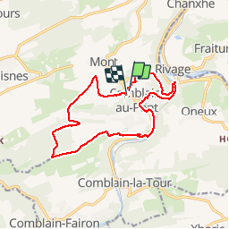

Length
13.3 km

Max alt
268 m

Uphill gradient
353 m
Km-Effort
18 km

Min alt
96 m

Downhill gradient
351 m
Boucle
Yes
Creation date :
2016-03-13 00:00:00.0
Updated on :
2016-03-13 00:00:00.0
2h49
Difficulty : Difficult

FREE GPS app for hiking
 SityTrail
IGN / Geographical institutes
SityTrail Plus
The world is yours!
About
Trail Walking of 13.3 km to be discovered at Wallonia, Liège, Comblain-au-Pont. This trail is proposed by mvdk54.
Description
Marche Adeps
Positioning
Country:
Belgium
Region :
Wallonia
Department/Province :
Liège
Municipality :
Comblain-au-Pont
Location:
Comblain-au-Pont
Start:(Dec)
Start:(UTM)
682460 ; 5594914 (31U) N.
Comments