


balade parcours de santé vals

raab
User
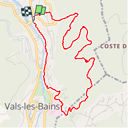

Length
5.9 km

Max alt
403 m

Uphill gradient
172 m
Km-Effort
8.2 km

Min alt
244 m

Downhill gradient
173 m
Boucle
Yes
Creation date :
2018-07-30 16:23:38.969
Updated on :
2018-07-30 16:23:38.983
1h50
Difficulty : Easy

FREE GPS app for hiking
 SityTrail
IGN / Geographical institutes
SityTrail Plus
The world is yours!
About
Trail Walking of 5.9 km to be discovered at Auvergne-Rhône-Alpes, Ardèche, Vals-les-Bains. This trail is proposed by raab.
Positioning
Country:
France
Region :
Auvergne-Rhône-Alpes
Department/Province :
Ardèche
Municipality :
Vals-les-Bains
Location:
Unknown
Start:(Dec)
Start:(UTM)
608283 ; 4946730 (31T) N.
Comments
superbe petite ballade à se faire très reposante🥰🥰🥰