


20160322-Pont St Pierre

doudet
User
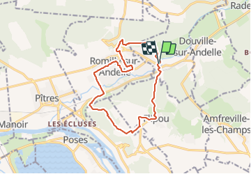

Length
13.3 km

Max alt
154 m

Uphill gradient
276 m
Km-Effort
17 km

Min alt
8 m

Downhill gradient
275 m
Boucle
Yes
Creation date :
2018-09-11 09:11:49.41
Updated on :
2018-09-11 09:11:49.41
3h39
Difficulty : Medium

FREE GPS app for hiking
 SityTrail
IGN / Geographical institutes
SityTrail Plus
The world is yours!
About
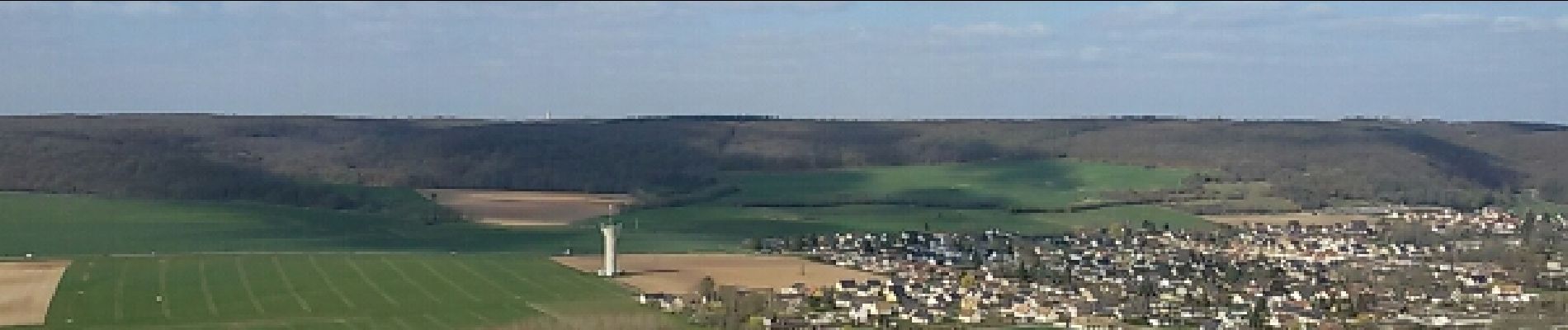
Trail Walking of 13.3 km to be discovered at Normandy, Eure, Pont-Saint-Pierre. This trail is proposed by doudet.
Description
Boucle A-R au départ de l'allée du Chateau
Photos


Positioning
Country:
France
Region :
Normandy
Department/Province :
Eure
Municipality :
Pont-Saint-Pierre
Location:
Unknown
Start:(Dec)
Start:(UTM)
375075 ; 5465828 (31U) N.
Comments