


Aiguèze Rocher Castelviel

raivavae
User
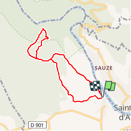

Length
7.4 km

Max alt
279 m

Uphill gradient
239 m
Km-Effort
10.6 km

Min alt
92 m

Downhill gradient
239 m
Boucle
Yes
Creation date :
2016-03-27 00:00:00.0
Updated on :
2019-04-21 13:32:03.219
2h13
Difficulty : Medium

FREE GPS app for hiking
 SityTrail
IGN / Geographical institutes
SityTrail Plus
The world is yours!
About
Trail Walking of 7.4 km to be discovered at Occitania, Gard, Aiguèze. This trail is proposed by raivavae.
Description
Parking place du portail haut
Positioning
Country:
France
Region :
Occitania
Department/Province :
Gard
Municipality :
Aiguèze
Location:
Unknown
Start:(Dec)
Start:(UTM)
624049 ; 4906892 (31T) N.
Comments