


reco vtt photo CTDCCR2016

mouss65
User
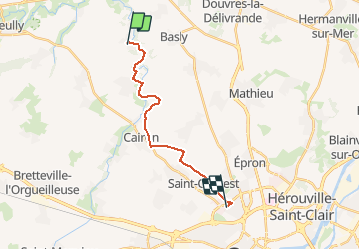

Length
14.1 km

Max alt
78 m

Uphill gradient
162 m
Km-Effort
16.1 km

Min alt
17 m

Downhill gradient
114 m
Boucle
No
Creation date :
2016-04-06 00:00:00.0
Updated on :
2016-04-06 00:00:00.0
1h09
Difficulty : Easy

FREE GPS app for hiking
 SityTrail
IGN / Geographical institutes
SityTrail Plus
The world is yours!
About
Trail Mountain bike of 14.1 km to be discovered at Normandy, Calvados, Fontaine-Henry. This trail is proposed by mouss65.
Description
vtt photo Fontaine Henri gymnase Claudel Caen
Photos


Positioning
Country:
France
Region :
Normandy
Department/Province :
Calvados
Municipality :
Fontaine-Henry
Location:
Unknown
Start:(Dec)
Start:(UTM)
685117 ; 5461301 (30U) N.
Comments