Trail Walking Savonnières-en-Perthois - 17/17a Vallées de l'Ornain et de la Saulx - Photo

17/17a Vallées de l'Ornain et de la Saulx

 cath310
cath310

User

© OpenStreetMap contributors
Length
Length
26 km
Max alt
Max alt
298 m
Uphill gradient
Uphill gradient
384 m
Km-Effort
Km-Effort  
31 km
Min alt
Min alt
161 m
Downhill gradient
Downhill gradient
375 m
Boucle
Boucle
Yes
Creation date :
2016-04-11 00:00:00.0
Updated on :
2016-04-11 00:00:00.0

(2 Reviews)

Walking
Walking
6h45
Difficulty : Medium

Scan this QR Code to open this trail in the SityTrail application

FREE GPS app for hiking

Logo SityTrail SityTrail

IGN / Geographical institutes

Download SityTrail from the App Store Download SityTrail from Google Play

Logo SityTrail SityTrail Plus

The world is yours!

Download SityTrail from the App Store Download SityTrail from Google Play Download SityTrail on Huawei AppGallery

About

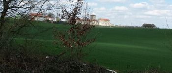
Trail Walking of 26 km to be discovered at Grand Est, Meuse, Savonnières-en-Perthois. This trail is proposed by cath310.

Description

D/R : SAVONNIERES-EN-PERTHOIS
Place de l'église
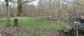
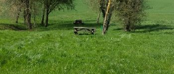
sur la route chêne PARIS-SAIGON avc coin pique-nique, abbaye de Jovilliers...
tbelle randonnée faite le 10/04/2016

Elevation profile

Photos

Points of interest

Point of interest Juvigny-en-Perthois - Point 1 - Photo
cath310
JUVIGNY-EN-PERTHOIS 
Point of interest Stainville - Point 3 - Photo
cath310
STAINVILLE 
Point of interest Stainville - Point 4 - Photo
cath310
STAINVILLE 
Point of interest Savonnières-en-Perthois - Point 5 - Photo
cath310
SAVONNIÈRES-EN-PERTHOIS 
Point of interest Aulnois-en-Perthois - Point 7 - Photo
cath310
AULNOIS-EN-PERTHOIS 

Positioning

Country:
France
Region :
Grand Est
Department/Province :
Meuse
Municipality :
Savonnières-en-Perthois
Location:
Unknown
Start:(UTM)
657064 ; 5385520 (31U) N.

Comments

Please log in to post a review or rate the element


tbelle randonnée


tbelle randonnée


Close
My subscriptions