


Val de creuë

kikkko
User
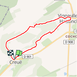

Length
7.6 km

Max alt
376 m

Uphill gradient
157 m
Km-Effort
9.7 km

Min alt
256 m

Downhill gradient
158 m
Boucle
Yes
Creation date :
2016-04-27 00:00:00.0
Updated on :
2016-04-27 00:00:00.0
2h05
Difficulty : Easy

FREE GPS app for hiking
 SityTrail
IGN / Geographical institutes
SityTrail Plus
The world is yours!
About
Trail Walking of 7.6 km to be discovered at Grand Est, Meuse, Vigneulles-lès-Hattonchâtel. This trail is proposed by kikkko.
Description
jolie randonnée dans les vergers puis en forêt balisée rond jaune
Positioning
Country:
France
Region :
Grand Est
Department/Province :
Meuse
Municipality :
Vigneulles-lès-Hattonchâtel
Location:
Unknown
Start:(Dec)
Start:(UTM)
695449 ; 5427040 (31U) N.
Comments