


Retinnr

mvdk54
User

Length
12 km

Max alt
278 m

Uphill gradient
222 m
Km-Effort
14.9 km

Min alt
160 m

Downhill gradient
222 m
Boucle
Yes
Creation date :
2016-05-02 00:00:00.0
Updated on :
2016-05-02 00:00:00.0
2h19
Difficulty : Unknown

FREE GPS app for hiking
 SityTrail
IGN / Geographical institutes
SityTrail Plus
The world is yours!
About
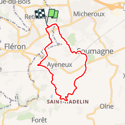
Trail Walking of 12 km to be discovered at Wallonia, Liège, Fléron. This trail is proposed by mvdk54.
Description
marche Adeps
Positioning
Country:
Belgium
Region :
Wallonia
Department/Province :
Liège
Municipality :
Fléron
Location:
Retinne
Start:(Dec)
Start:(UTM)
691349 ; 5611787 (31U) N.
Comments