Trail Walking La Roche-des-Arnauds - 
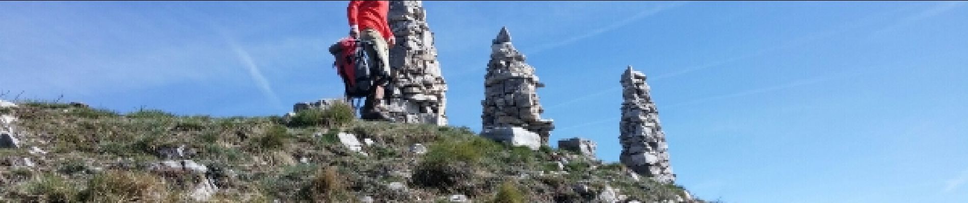
Tête de la Clappe.04 05 16 - Photo
© OpenStreetMap contributors
Length
Length
8.6 km
Max alt
Max alt
2002 m
Uphill gradient
Uphill gradient
841 m
Km-Effort
Km-Effort  
19.8 km
Min alt
Min alt
1161 m
Downhill gradient
Downhill gradient
839 m
Boucle
Boucle
Yes
Creation date :
2016-05-05 00:00:00.0
Updated on :
2016-05-05 00:00:00.0

(0 Reviews)

Walking
Walking
3h43
Difficulty : Medium

Scan this QR Code to open this trail in the SityTrail application

FREE GPS app for hiking

Logo SityTrail SityTrail

IGN / Geographical institutes

Download SityTrail from the App Store Download SityTrail from Google Play

Logo SityTrail SityTrail Plus

The world is yours!

Download SityTrail from the App Store Download SityTrail from Google Play Download SityTrail on Huawei AppGallery

About

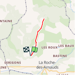
Trail Walking of 8.6 km to be discovered at Provence-Alpes-Côte d'Azur, Hautes-Alpes, La Roche-des-Arnauds. This trail is proposed by Dervalmarc.

Description

Parking un kilomètre cent cinquante a droite après avoir pris la piste de M atachare.
Rando sportive .Aérienne sur une ligne de crête sur les deux tiers du parcours.Point de vue superbe à 360 degrés à la cime.Petite vigilence requise avant la cime ainsi qu'à la descente sur une dizaine de mètres.

Elevation profile

Photos

Positioning

Country:
France
Region :
Provence-Alpes-Côte d'Azur
Department/Province :
Hautes-Alpes
Municipality :
La Roche-des-Arnauds
Location:
Unknown
Start:(UTM)
733393 ; 4939481 (31T) N.


Close
My subscriptions